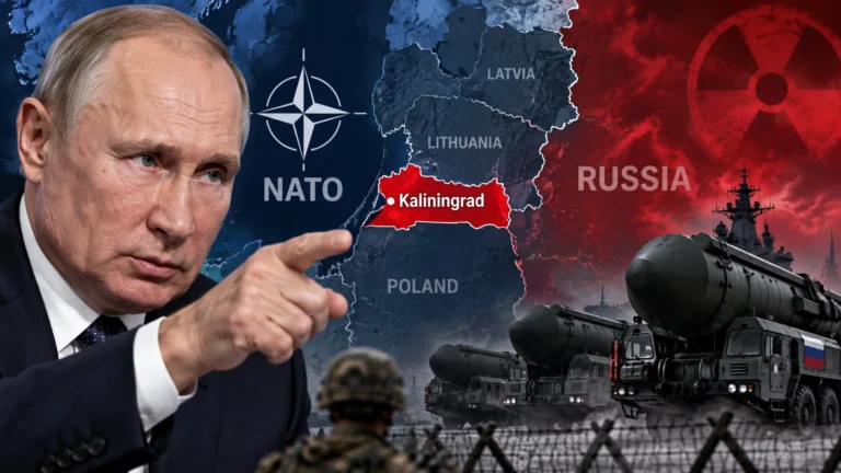
Did the U.N. Really Change the World Map? What the 164–1 Equal Earth Resolution Means—and Why the U.S. Said No

Did the United Nations just replace the world map?
And did the United States vote against the change because the new map makes America look smaller?
Not quite.
On September 4, 2026, the U.N. General Assembly adopted the “Correct the Map” resolution by 164 votes to 1, with six abstentions. The United States cast the only vote against it. (United Nations · Reuters)
But the vote did not redraw national borders, ban the familiar Mercator projection, or force every school, government, publisher, or mapping service to use one new official map.
That distinction is the most important part of the story.
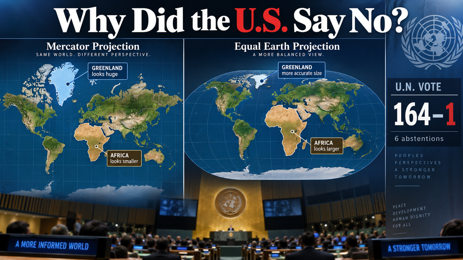
※ Images in this article are AI-generated illustrations created to help explain the story. They are not actual photographs, and depictions of people, places, or events may differ slightly from reality.
The dispute is really about a problem every flat map has: you cannot flatten a globe without distorting something.
For centuries, the question has been which distortion we are willing to accept.
What Did the U.N. Actually Decide?
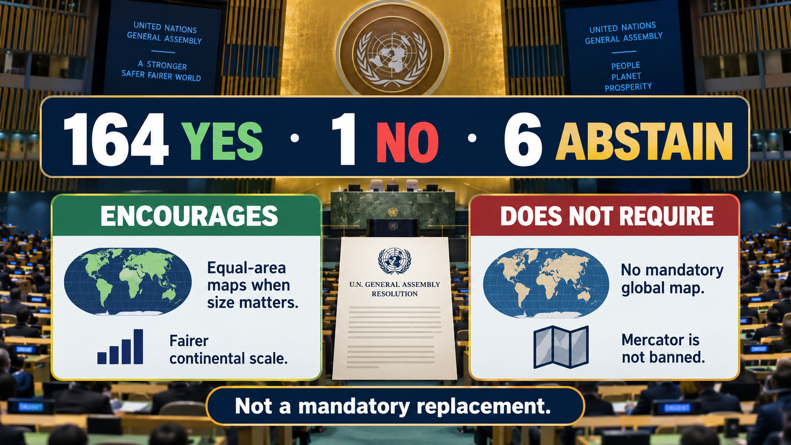
The General Assembly adopted a resolution titled “Correct the map: rebalancing global cartographic representation and promoting equitable representation of the world’s regions, particularly Africa.” It was circulated as draft A/80/L.104 and, after adoption, recorded as A/RES/80/307. (United Nations · U.N. General Assembly record)
The measure encourages greater use of Equal Earth and other equal-area projections when relative landmass size matters. It is nonbinding on member states and does not outlaw the Mercator projection or establish one mandatory world map. (U.N. Office of the Special Adviser on Africa · Reuters)
Here is the easiest way to separate the headline from the actual decision:
| What the headline can sound like | What actually happened |
|---|---|
| The U.N. adopted a new mandatory world map | The General Assembly encouraged wider use of equal-area projections |
| Mercator is now banned | Mercator remains available and useful for some purposes |
| Every country must switch to Equal Earth | The resolution does not impose one projection on every use |
| National borders changed | The vote concerned map projection, not sovereignty or borders |
| Equal Earth is distortion-free | It preserves area, but other geographic properties are still distorted |
Togo, which introduced the measure on behalf of the African Group, explicitly said the effort was not intended to condemn Mercator or impose one projection for every purpose. (U.N. General Assembly transcript)
So the U.N. did not “redraw the world” in a legal or territorial sense.
It endorsed a different answer to a much narrower question:
When people look at an entire world map, should the relative size of the continents be shown accurately?
Why Does Mercator Make Greenland Look Almost as Big as Africa?
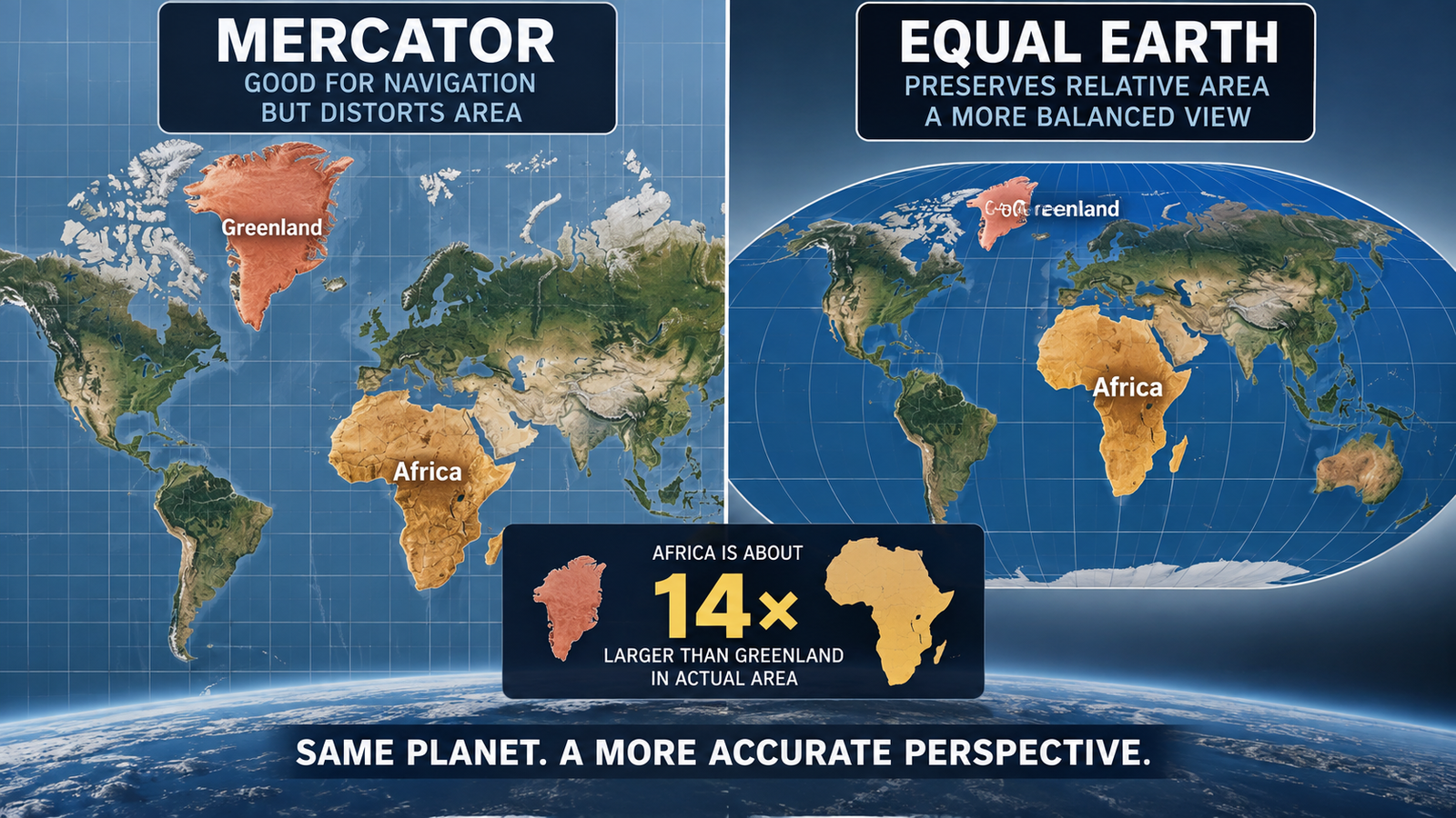
Because Mercator was designed to preserve something other than area.
Gerardus Mercator introduced the projection in 1569. Its great advantage was that it preserved local angles and allowed constant compass bearings to be plotted as straight lines—an extremely useful feature for navigation. (U.N. Office of the Special Adviser on Africa)
The trade-off is dramatic.
As you move farther from the Equator, landmasses become increasingly enlarged on a Mercator map. That is why Greenland can appear roughly comparable in size to Africa even though Africa is about 14 times larger in actual area. (U.N. Office of the Special Adviser on Africa · AP)
That does not mean someone simply drew Africa at the wrong size.
It is a mathematical consequence of what the projection was designed to preserve.
Imagine trying to flatten the peel of an orange onto a table without tearing, stretching, or compressing it. Something has to give.
World maps face the same basic problem.
Mercator preserves angles. The price is severe area distortion toward the poles.
That makes places such as Greenland, northern Canada, northern Europe, and Russia appear disproportionately large relative to regions closer to the Equator.
Africa is not so much “shrunk” by Mercator as high-latitude landmasses are enlarged relative to it.
That is a more accurate way to describe the distortion.
What Does Equal Earth Fix—and What Does It Still Distort?
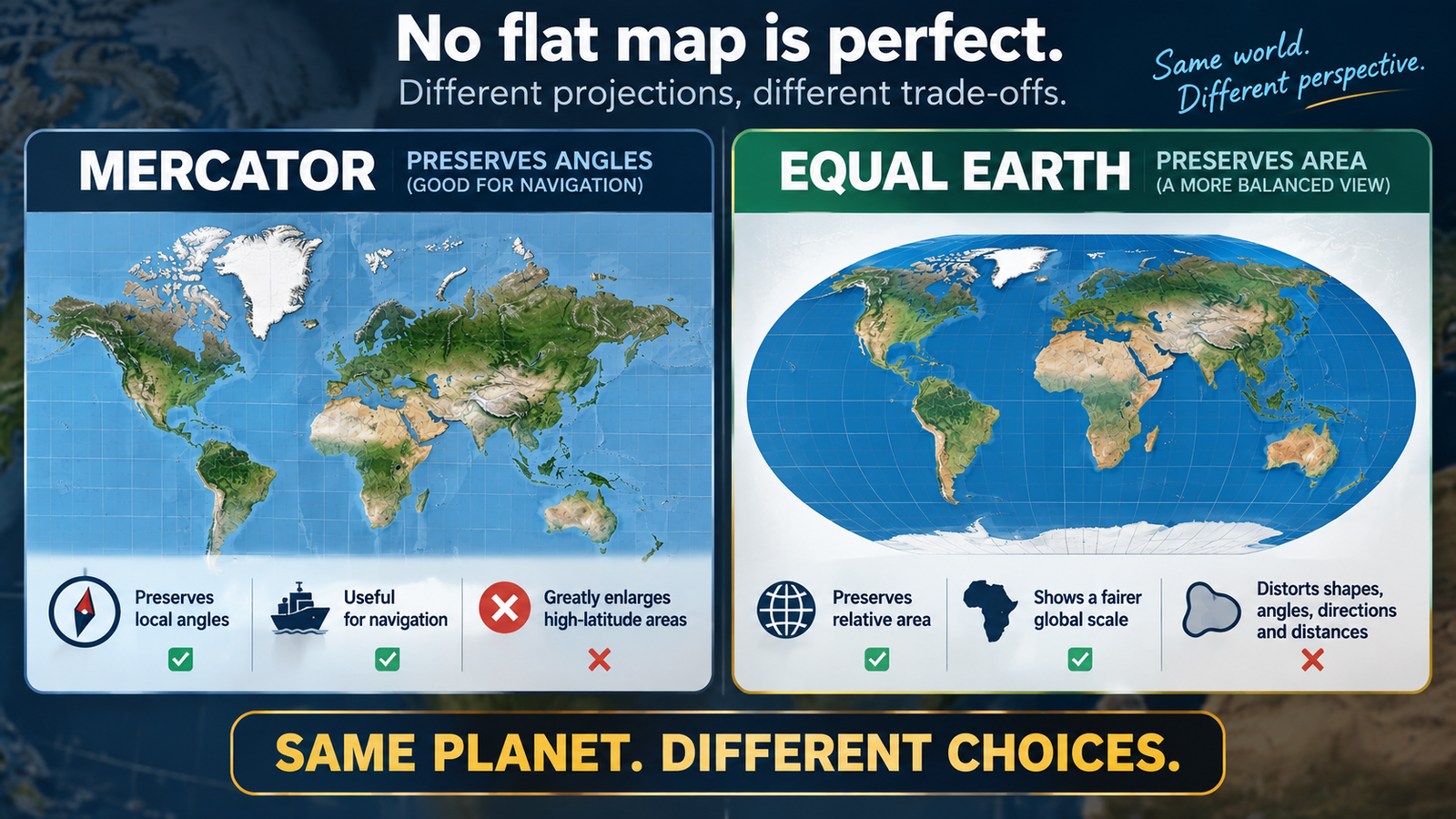
Equal Earth solves the specific problem at the center of the U.N. debate: relative area.
Cartographers Bojan Šavrič, Tom Patterson, and Bernhard Jenny developed the projection in 2018. Their research describes it as an equal-area projection designed to retain the relative size of areas while giving world maps a balanced, familiar appearance. (International Journal of Geographical Information Science)
That means a region covering twice as much area on Earth also occupies twice as much area on an Equal Earth map.
But Equal Earth is not a perfect copy of the globe.
Esri’s technical documentation notes that although area is preserved, shape, direction, angles, and distances are distorted to varying degrees. (Esri)
The real comparison therefore looks like this:
| Projection | What it does especially well | Major trade-off |
|---|---|---|
| Mercator | Preserves local angles and constant-bearing lines | Greatly enlarges high-latitude areas |
| Equal Earth | Preserves relative area | Distorts shapes, angles, directions, and distances |
| Globe | Avoids the basic flattening problem of a flat world map | Harder to reproduce on a flat page or screen |
That is why saying “Mercator is false and Equal Earth is true” is too simplistic.
A better question is:
What job is the map supposed to do?
If the goal is to compare the sizes of Africa, Europe, and North America, an equal-area projection is much more informative.
If another geographic property matters more, a different projection may make more sense.
Why Did African Countries Push This Issue So Hard?
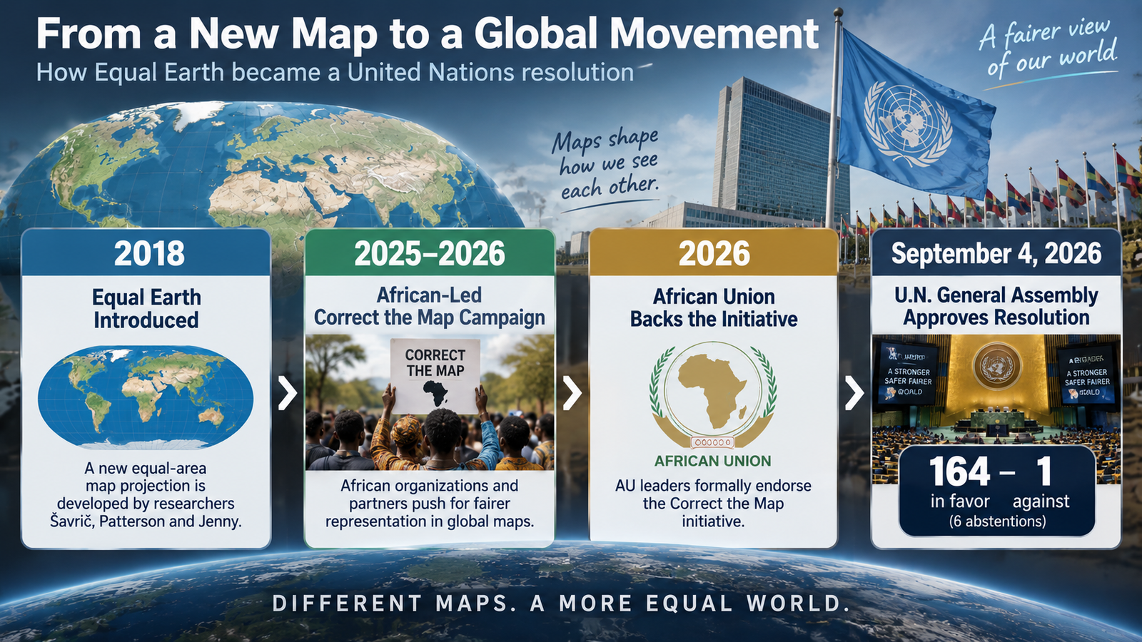
Because supporters argue that maps do more than describe geography. They also shape how people intuitively imagine the importance and scale of different parts of the world.
The African Union backed the Correct the Map initiative and in 2026 formally endorsed efforts to promote more accurate representations of Africa’s scale. (African Union)
The campaign had also been promoted by advocacy groups including Africa No Filter and Speak Up Africa, which argued that the familiar Mercator image reinforces a misleading sense of Africa’s relative size. (Reuters)
That argument mixes cartography with politics, history, and education.
Supporters describe a progression that looks roughly like this:
| Stage | What changed |
|---|---|
| 2018 | Equal Earth was introduced as a modern equal-area projection |
| 2025–2026 | The Correct the Map campaign gained broader institutional backing |
| 2026 | African Union leaders endorsed the initiative |
| September 4, 2026 | The U.N. General Assembly approved the resolution 164–1, with six abstentions |
The resolution describes correcting inherited distortions as an act of “cognitive justice and memorial reparation.” It also says those distortions have contributed to the “symbolic minimization” of Africa in collective perceptions. (U.N. Office of the Special Adviser on Africa)
That language is important because it helps explain both the overwhelming support and the American opposition.
The disagreement was no longer just about geometry.
It had become a disagreement over what the map symbolizes.
So Why Was the United States the Only Country to Vote No?
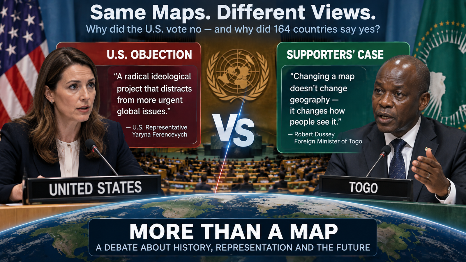
The stated U.S. objection was political and institutional, not a claim that Mercator represents land area more accurately.
Before the vote, Deputy U.S. Representative to the U.N. Economic and Social Council Yaryna Ferencevych called the measure part of a broader “radical ideological project.” She objected to the resolution’s references to reparations and “cognitive justice” and argued that the General Assembly should focus on issues such as international peace, prosperity, and relations among states. (U.S. Mission to the United Nations · U.N. Office of the Special Adviser on Africa)
The American argument was essentially this:
The U.N. has more urgent responsibilities, and turning a technical mapping issue into a debate about historical justice adds an ideological agenda that distracts from those priorities.
Supporters saw almost the opposite problem.
| U.S. objection | Supporters’ argument |
|---|---|
| The resolution turns cartography into an ideological political project | Maps already influence perception and are not entirely neutral in their effects |
| The U.N. should focus on more urgent global problems | Education and representation are legitimate international issues |
| References to reparations and cognitive justice politicize the subject | Historical distortions deserve explicit acknowledgment |
| A map debate does not change real geopolitical power | The goal is to change inaccurate visual perception, not material power |
Togo’s Foreign Minister Robert Dussey acknowledged that changing a map does not change geography. His argument was that it changes how people see geography. (U.N. General Assembly transcript)
There is an important factual line to draw here.
Some critics of the U.S. vote may interpret Washington’s position as defending a Western-centered visual order.
But the official U.S. explanation did not say that the United States wanted to preserve a map because North America looks larger on it.
The stated U.S. objection concerned ideology, reparations, institutional priorities, and the role of the United Nations.
Those are different claims, and they should not be blurred together.
Does This Mean the Maps Americans Use Are About to Change?
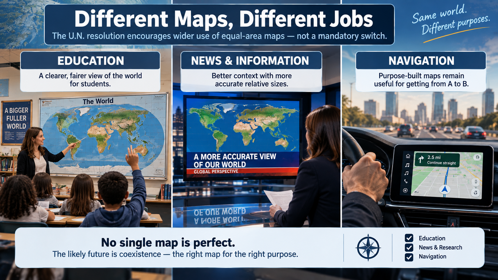
No. There will be no single deadline when familiar maps disappear.
The resolution encourages governments, educators, international organizations, media, and technology companies to use equal-area representations when relative size matters. It does not prescribe one projection for every mapping task. (U.N. Office of the Special Adviser on Africa · Reuters)
That means the most visible changes could come gradually in places such as:
- school textbooks and classroom wall maps,
- news graphics,
- international-development reports,
- demographic and climate maps,
- government publications,
- world maps intended primarily to compare countries or continents by area.
Navigation is a different problem.
A projection that is excellent for showing relative area may be less useful for another task. That is why cartographers choose projections according to what information needs to remain most accurate.
The practical future is more likely to be coexistence among projections than the disappearance of Mercator.
That may sound less dramatic than “the world is getting a new map.”
But it is much closer to what the U.N. actually decided.
The Bigger Lesson: There Is No Completely Neutral Flat World Map
The most useful part of this controversy may be something neither side disputes: every flat world map makes choices.
The Earth is curved.
The page and screen are flat.
Once you move from one to the other, some combination of area, shape, angle, direction, or distance must be distorted. (Esri)
So instead of asking, “Which map is the one true map?” there are three better questions:
| Question | Why it matters |
|---|---|
| What needs to remain accurate? | Area, direction, distance, and shape cannot all be perfectly preserved on a flat world map |
| What is the map being used for? | Navigation and a classroom comparison of continents have different needs |
| What impression will the distortion create? | Mathematical choices can affect how viewers perceive scale |
That is why this argument became much larger than a cartography debate.
For African governments and campaigners, the Mercator map’s familiar appearance carries a historical and educational cost.
For the United States, the U.N. resolution wrapped a technical issue in political concepts that Washington viewed as ideological overreach.
Both positions operate on a level beyond simple geography.
The map did not suddenly become political in 2026.
The 2026 vote made the politics surrounding how the world is pictured unusually visible.
Bottom Line: What This Story Really Means
The United Nations did not order the world to throw away the Mercator map or adopt a single mandatory replacement.
It encouraged wider use of equal-area projections such as Equal Earth when accurately comparing the size of continents is important.
The reason is easy to see: Mercator’s design dramatically enlarges high-latitude regions, making places such as Greenland look far larger relative to Africa than they really are.
Equal Earth corrects that particular problem by preserving area—but it still distorts other geographic properties.
And the United States’ lone “No” vote was not officially an argument that the Mercator projection is more accurate for comparing land area. Washington objected to the resolution’s broader political language about historical representation, reparations, and “cognitive justice,” and argued that the U.N. had more important priorities.
So the real debate is not simply old map versus new map.
It is about which distortions a map should accept, what maps teach us without words, and how far an international institution should go in treating representation as a political issue.
Equal Earth Map: Key Questions Explained
Q. Did the United Nations officially replace the Mercator world map?
No. The General Assembly adopted a nonbinding resolution encouraging wider use of equal-area projections when relative landmass size matters. It did not outlaw Mercator or impose one mandatory map worldwide. (United Nations · Reuters)
Q. What was the vote on the Equal Earth resolution?
The resolution passed 164–1 with six abstentions on September 4, 2026. The United States cast the only vote against it. (U.N. General Assembly record)
Q. Why does Greenland look so large on a Mercator map?
Mercator increasingly enlarges area as latitude rises because of the way the projection preserves angles and constant-bearing navigation lines. Greenland therefore appears much larger relative to equatorial regions than it actually is.
Q. How much larger is Africa than Greenland?
Africa is roughly 14 times larger than Greenland by area, even though a Mercator world map can make the two appear surprisingly similar in size. (U.N. Office of the Special Adviser on Africa)
Q. What is special about the Equal Earth projection?
Equal Earth is an equal-area projection, meaning relative surface areas are preserved. It was developed by Bojan Šavrič, Tom Patterson, and Bernhard Jenny and introduced in 2018. (International Journal of Geographical Information Science)
Q. Is Equal Earth completely accurate?
No flat world map can preserve every geographic property at once. Equal Earth preserves area but distorts characteristics including shape, angles, direction, and distance. (Esri)
Q. Why did the United States vote against the resolution?
The stated U.S. objection focused on the resolution’s political and ideological framing. The U.S. representative criticized its references to reparations and “cognitive justice” and argued that the U.N. should focus on more urgent international problems. (U.S. Mission to the United Nations)
Q. Did the United States say it wanted America to look larger on world maps?
No. That was not the official U.S. explanation for its vote. The stated objections concerned ideology, historical reparations, U.N. priorities, and institutional credibility.
Q. Will navigation maps have to switch to Equal Earth?
No. The resolution does not require one projection for every use. Different projections remain useful for different mapping purposes, and Equal Earth is particularly suited to situations where accurate relative area is important.
Did this help make the story clearer? 🙂 WIN keeps unpacking the “why” behind the news—clearly and simply!
Sources
U.N. Resolution, Vote, and U.S. Position
United Nations General Assembly Resolution A/RES/80/307
United Nations General Assembly 80th Session Resolution Register
United Nations General Assembly 114th Plenary Meeting Transcript
U.S. Mission to the United Nations — Explanation of Vote on “Correct the Map”
Reuters — UN approves resolution in support of map that shows Africa’s true size
Associated Press — UN General Assembly endorses a world map that more accurately shows Africa’s size
Equal Earth and Map-Projection Science
Šavrič, Patterson, and Jenny — The Equal Earth map projection
Esri — Equal Earth Projection Properties and Distortion
African-Led Campaign and Institutional Backing
African Union — AU leaders adopt historic initiative to Correct the Map of Africa
African Union — Communiqué on the adoption of the “Correct The Map” resolution
Reuters — Togo to ask U.N. member states to use map showing Africa’s true size